
 English
 Español
 Deutsch
 日本語
日本語 Polska
 Français
 中國
中國 한국의
한국의 Українська
 Italiano
 Nederlands
 Türkçe
 Português
 Bahasa Indonesia
 Русский
 हिंदी
हिंदीMaryland Topographic Map STL Model 3D Baskı Modeli


- Hazır formatlar: Stereolithography: stl 361.39 MB
- Koleksiyon:No
- Genişlik (mm):198
- Yükseklik (mm):1.4
- Derinlik (mm):103
- Baskıya Hazır:
- 3D Tarama:No
- Yetişkin(+18) içerik:No
- PBR:No
- AI Eğitim:No
- Görüntülemeler:1920
- Tarih: 2022-06-17
- Ürün ID:402310
- Not:
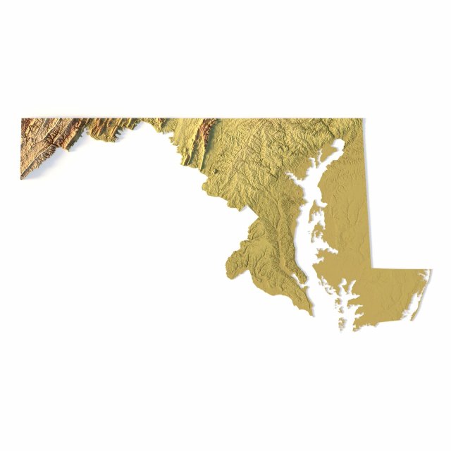
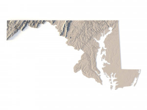
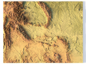
Create Detailed Maryland Terrain Models with This High-Resolution 3D STL
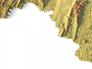
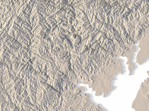
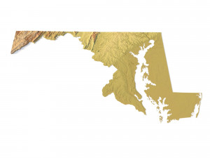
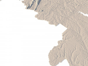
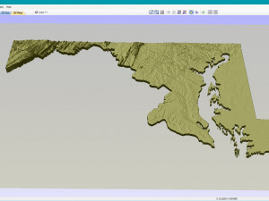
The Maryland Topographic Map STL model offers a high-resolution representation of the state’s diverse topography and geographic features. This 3D model is ideal for creating physical relief maps from materials such as wood, metal, plastic, or concrete. Whether used for landform visualization, educational projects, or professional GIS applications, this model provides precise elevation data for detailed terrain modeling. It’s perfect for 3D printing, CNC machining, and laser engraving.
- File size: 745 MB / 370 MB
- Model size: 197.61 mm x 103.41 mm x 1.352 mm
- Resolution: 0,03 mm
- Projection: Mercator
- Scaling factor: X — 1; Y — 1; Z — 3
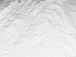
- Polygons: 15 632 244
- Vertices: 7 852 008
- Geometry: Polygonal Tris only
- Base: Open / Closed
Features of the Maryland Topographic STL Model
Accurate elevation data showcasing Maryland’s diverse landforms, from coastal plains to mountainous regions.
Compatible with FDM/SLA 3D printers for creating high-quality terrain models.
Designed for CNC machining to craft detailed relief maps from wood or metal.
Supports high-precision laser engraving for metal surface detailing.
Farklı bir formata ihtiyaç duyuyorsanız lütfen destek ekibimize bir talep açarak ihtiyacınızı belirtiniz. 3D modelleri şu formatlara dönüştürebiliriz: .stl, .c4d, .obj, .fbx, .ma/.mb, .3ds, .3dm, .dxf/.dwg, .max. .blend, .skp, .glb. 3d sahneleri dönüştürmüyoruz ve .step, .iges, .stp, .sldprt gibi formatlar.!


